Last time I wrote about Paart's geography, I came up with this:
Now, I see how messy and hard it can be to get away with plate tectonics - as I had to move, and redraw each new map for the planet, account distortions by latitude and keep track of plate movement to keep it on track - a mess I believe no one may want to go through, myself included gave up on the fourth map of Paart's plate tectonics. I'm not saying you should give up on stuff, but it is rather silly to do certain things manually when you have the appropriate tools lying around.
While looking for solutions for my problem, I had stumbled across a website called Tectonics.js, it's purpose is to reproduce plate tectonics over time, and you can watch it evolve with a random seed, or import a heightmap as a starter for the process to take place. What is great for us, as we can provide a Pangea-analogue map and evolve it over time in a natural looking way - apart from what we would usually do by hand or using fractals, every ocean, every mountain, and coastline has it's own history behind it's shape.
Main page of Tectonics.js
So, I did loaded a map of Paart at age 4,2Gyr old, and watched it evolve over 600 million years - printing the screen every 25 million years - this process took about 10 minutes at 1Myr per second - and this was the result.
According to the simulation, the closest to the next super-continent it will get is 600Myr in the future (frame 21), when most of the landmass is shared by 3 neighboring plates.
Using this evolution of the landmasses, we can track where ancient rain forests lived and determine coal and oil rich points, and by that later determine which future countries or people around the world would be industrial powers due to the availability of those resources, what is a great starter for realistic geopolitics.
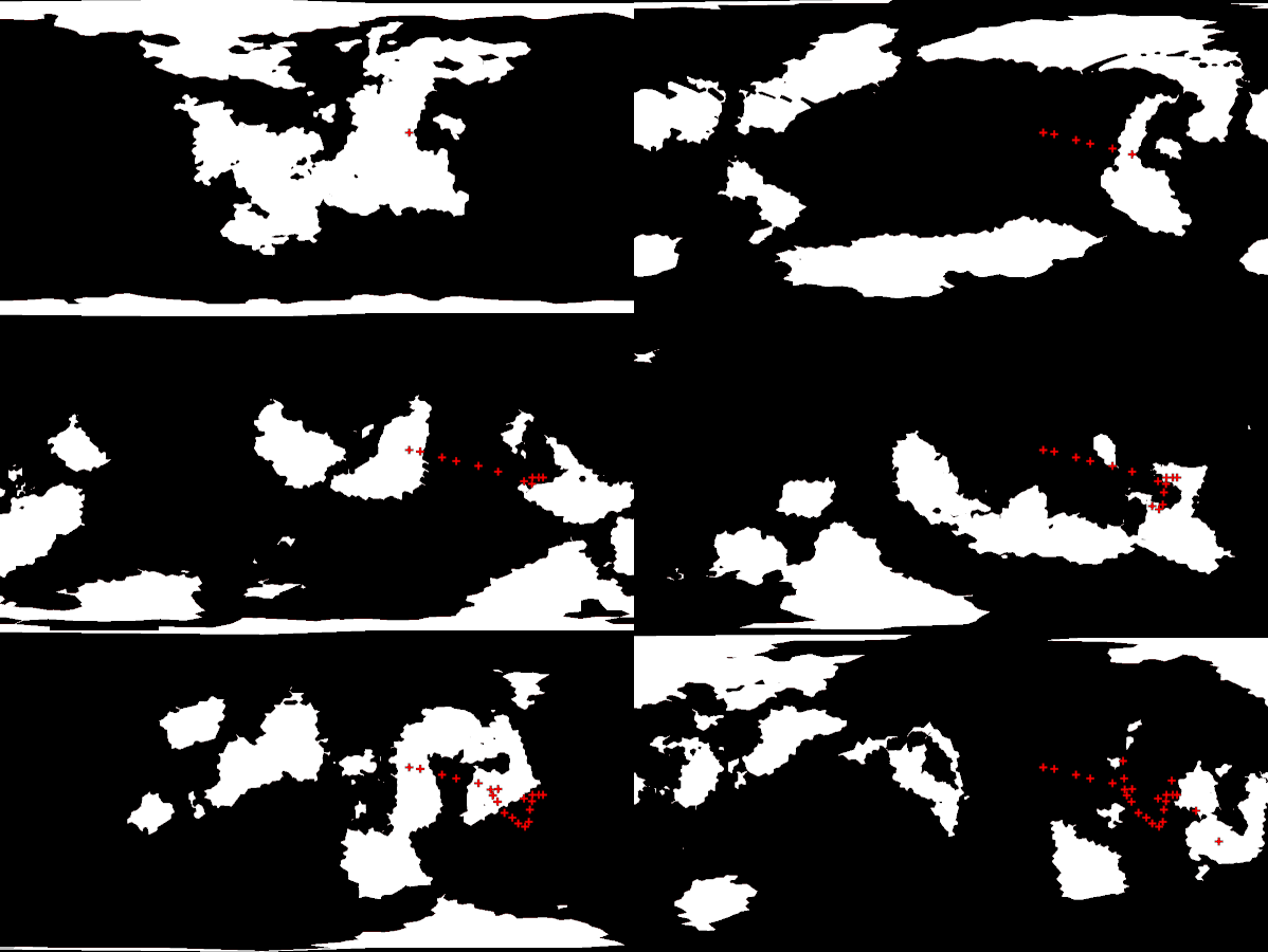
Here a + sign mark the place of a certain coal deposit through time:
I have chosen an interval of 420 million years to work with - by that I mean, that Paart's civilization will arise when the planet is roughly 4,62 billion years old.
Then working in 100Myr million year intervals, we get those climates (roughly):
Color code:
Rainforests
Savannas and humid regions
Hot regions, probably deserts
Dry regions
Tundras
Mountains
Ice
Then, most of the landmasses will be on the southern hemisphere of the planet, what makes most of the continents to have similar temperature ranges, it will be an era of greenness and warmth compared to previous eons.
As well, I marked sections of landmass that contained previous rainforests for long periods of time to mark fossil fuel rich places.
RED = OIL
With continental drift tracking, we can as well map the spread of fauna and flora over time, the same way some dinosaur species can be found on both South America and the west coast of Africa, or North America and Europe.
And looking back at our simulation, species from most of continents will have their ancestry either dating back ~50 million years, or as early 400 million years due isolation. What is not so bad, given that Pangea existed for about 340 million years, some creatures from Earth can be traced back to 250 million years ago.
As example, animals and plants from South America, Africa, and Australia had between 150 and 100 million years to diversify once they split apart.
Names in sanskrit based on their shape
I also named the continents for further reference when worldbuilding in the future.
Good modeling for everyone...
- M.O. Valent, 25/02/2020


